

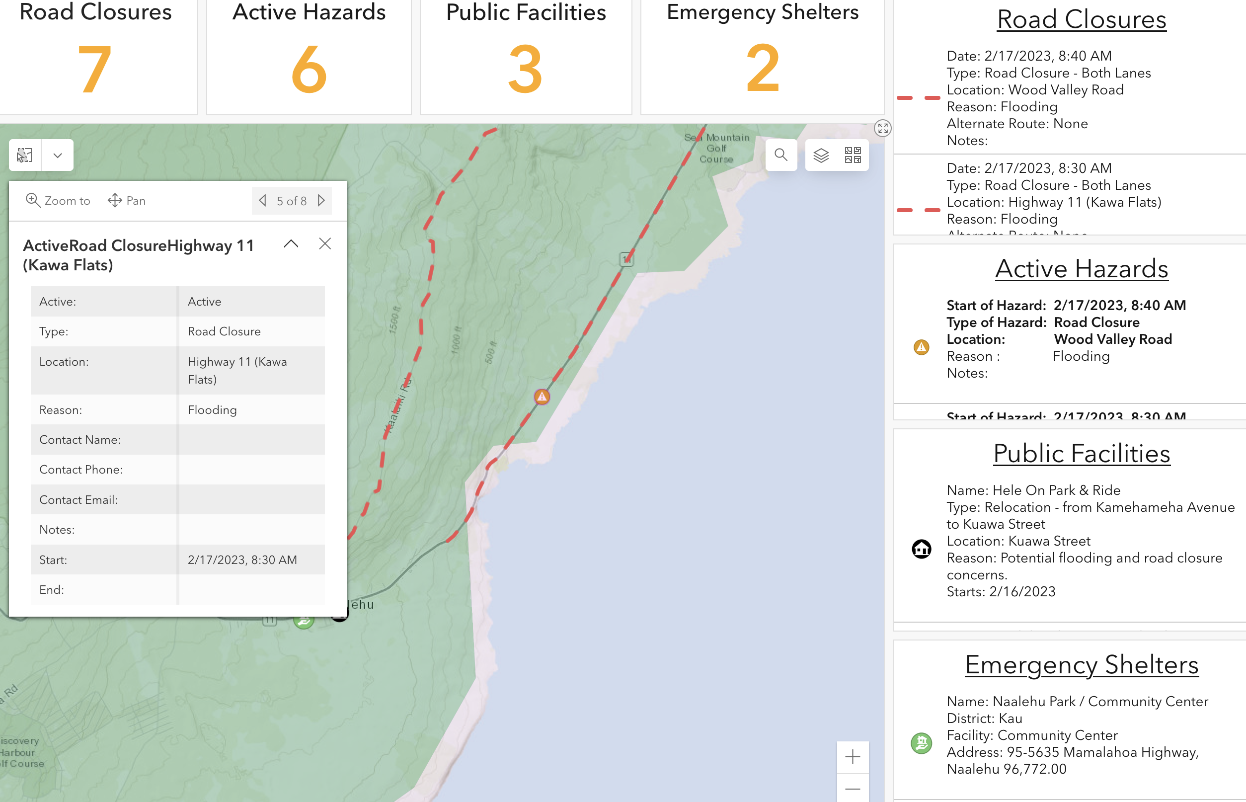
Hawaiʻi County officials have opened two shelters in Kaʻū due to a highway closure in the area due to heavy rainfall. The shelters are located at the Nāʻālehu Community Center and the Robert Herkes Gymnasium in Pāhala. They will remain open throughout the day and possibly into the evening, pending need and weather.
The Hawaiʻi Fire Department is also responding to an incident in the Kaʻū district involving a vehicle that was swept off the roadway and into an embankment after entering an active road closure zone. Officials are asking the public to remain vigilant and follow all signage, barricades, and diversions for their safety.
According to the National Weather Service, the County of Hawaiʻi is currently under a Flood Advisory, indicating flooding in the Southern and Eastern parts of the island.
The Waipiʻo Valley Access Road remains closed due to the early onset of the weather system, and more closures are expected in the coming days. The areas expected to see the most severe impacts are Kaʻū, Puna, and Hilo, including areas along the Hāmākua Coast to Waipiʻo Valley. West Hawaiʻi will also be impacted due to continued convection from the storm.
Road crews, utilities, Fire, and Police stand ready to address impacts caused by the anticipated weather as they occur to ensure public safety. Shelters have been identified in varying locations in the event that they become necessary.
The County has not requested the cancellation of any planned outdoor events or activities at this time but reminds residents that closures and/or cancellations may be necessary with little to no notice, pending the severity of the weather impacts.
However, the County of Hawaiʻi Parks and Recreation track meet scheduled for tomorrow, February 18, at Waiākea High School has been canceled.
Camping permits may also be terminated if necessary. The Department of Parks and Recreation will make that determination in real-time and contact permittees accordingly.
Officials will continue to monitor the situation and update the public as necessary.
The public can access information in real-time on the County of Hawaiʻi Civil Defense Hazard Map (https://tinyurl.com/2p845968) or via the County’s mobile application, Kāhea, which is available on both Android and iPhone.