

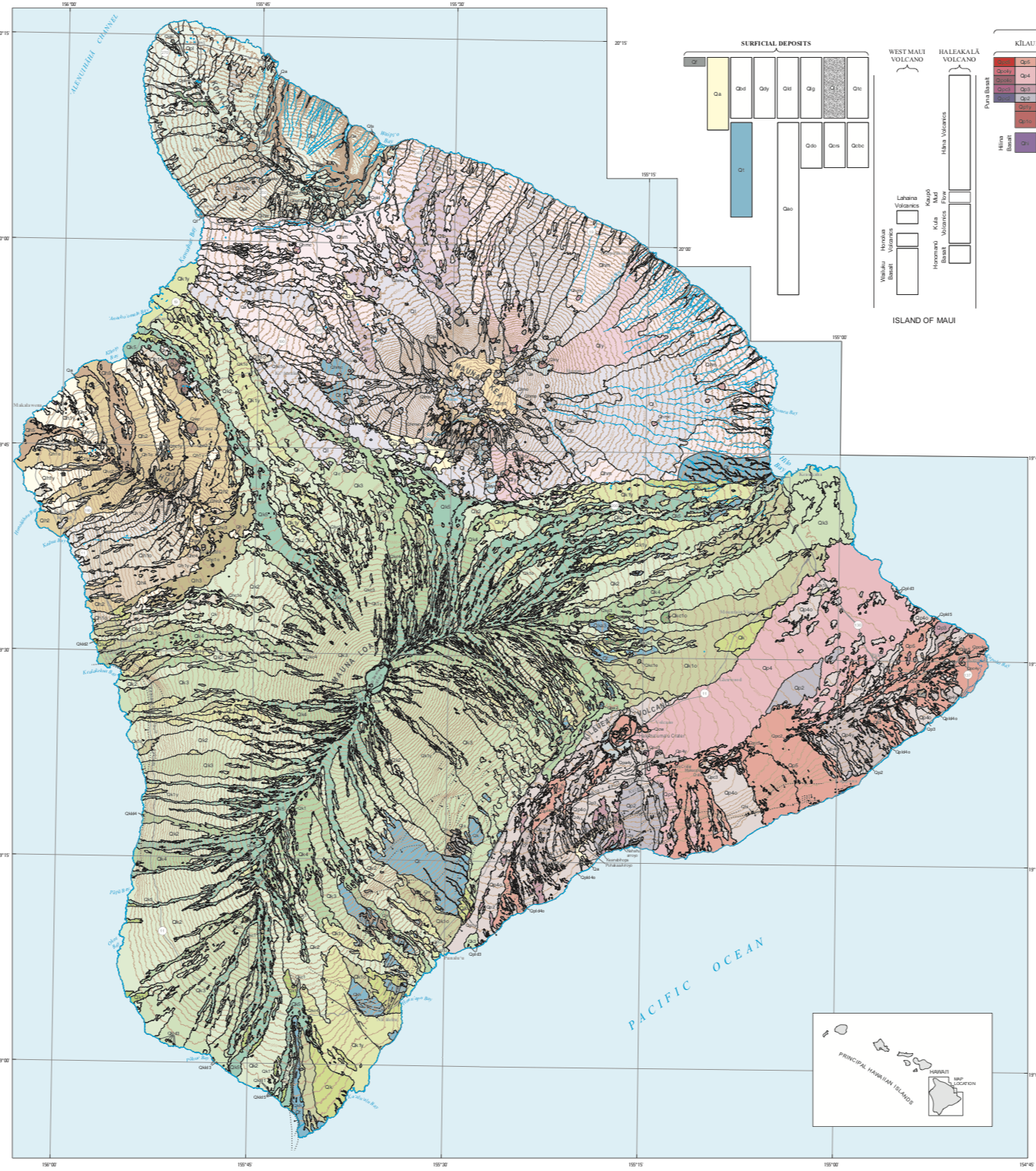
The USGS recently published a revised “Geologic Map of the State of Hawaii.” This map—originally published in 2007—has been updated to include more recent geologic deposits, including lava flows from Kīlauea’s Pu‘u‘ō‘ō vent on the middle East Rift Zone from 2007–2018 and lava flows erupted during Kīlauea’s 2018 lower East Rift Zone eruption.

These geologic maps and its digital databases present the geology of the eight major islands of the State of Hawaiʻi. The map should serve as a useful guide to anyone studying the geologic setting and history of Hawai‘i, including ground- and surface-water resources, economic deposits, and landslide or volcanic hazards. Its presentation in digital format allows the rapid application of geologic knowledge when conducting field work; analyzing land-use or engineering problems; studying onshore or nearshore biologic communities; or simply understanding the relation between the geology, scenery, and cultural history of the Hawaiian paradise.
The maps includes a Description of Map Units, which describes the lithologic characteristics and distribution of the geologic deposits. A Correlation of Map Units shows how the different geologic formations are related to each other stratigraphically. A fairly complete geospatial database of the radiometric ages and geochemical analyses has been compiled from findings published over the past 100 years by numerous Earth scientists working across the island chain.
Links
- Document: Pamphlet (14 MB pdf)
- Sheets:
- Sheet 1 (12 MB pdf) – Geologic Map of the State of Hawai‘i—Islands of Ni‘ihau and Kaua‘i
- Sheet 2 (9 MB pdf) – Geologic Map of the State of Hawai‘i—Island of O‘ahu
- Sheet 3 (6 MB pdf) – Geologic Map of the State of Hawai‘i—Islands of Moloka‘i, Lāna‘i, and Kaho‘olawe
- Sheet 4 (9 MB pdf) – Geologic Map of the State of Hawai‘i—Island of Maui
- Sheet 5 (17 MB pdf) – Geologic Map of the State of Hawai‘i—Island of Hawai‘i
- Related Work: Open-File Report 2007–1089 – Geologic Map of the State of Hawaiʻi
Citation
Sherrod, D.R., Sinton, J.M., Watkins, S.E., and Brunt, K.M., 2021, Geologic map of the State of Hawaiʻi: U.S. Geological Survey Scientific Investigations Map 3143, pamphlet 72 p., 5 sheets, scales 1:100,000 and 1:250,000, https://doi.org/10.3133/sim3143.