

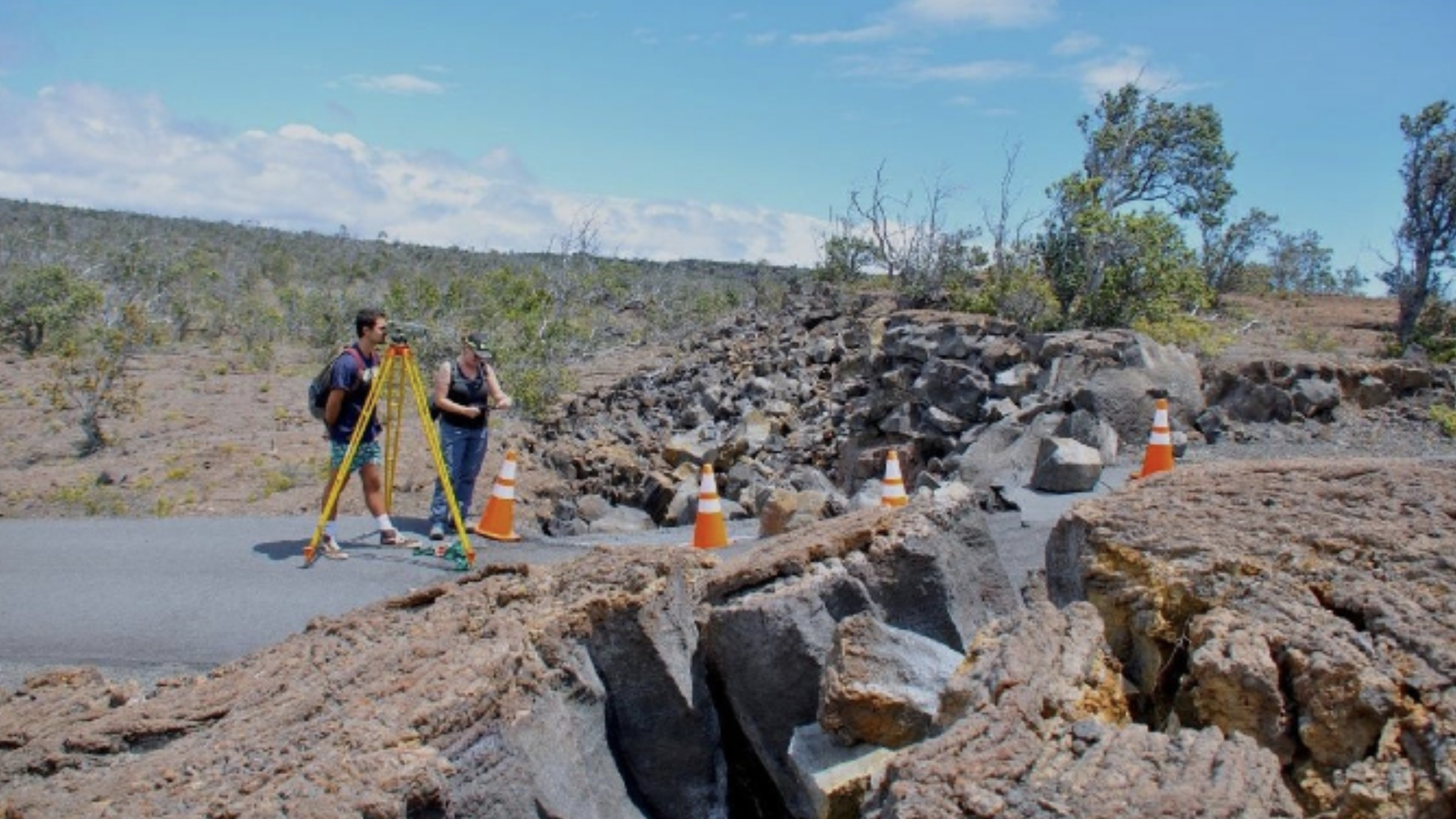
UH Hilo geology majors measure vertical offset of Hilina Pali road in Hawaiʻi Volcanoes National Park. (Photo credit: Steve Lundblad)
Since the 2018 Kīlauea volcano eruption, the Department of Geology at the University of Hawaiʻi at Hilo has partnered with Hawaiʻi Volcano Observatory (HVO) scientists to do “old school” leveling, a valuable measuring method to track changes in the Koaʻe fault system. UH Hilo has capable and enthusiastic geology students, and through the years, many have volunteered to measure the cracks and faults.
Students have played important roles in collecting and analyzing the data through conducting leveling research. Thus far, two groups of students have traveled to scientific conferences to present their findings.
“We are proud of the contributions these new researchers have made to the Island of Hawaiʻi community and the wider world of science,” said UH Hilo geology Professor Steve Lundblad, who penned a column about the research.
Koaʻe fault system
The Koaʻe fault system connects Kīlauea’s East and Southwest Rift Zones south of the caldera. Faults here appear as low cliffs or “scarps” along Hilina Pali Road in Hawaiʻi Volcanoes National Park. These fault-cliffs slip during major earthquakes, as happened on May 4, 2018, near the beginning of Kīlauea’s 2018 eruption.
U.S. Geological Survey scientists first began leveling along the Koaʻe faults in the 1960s, providing a long-standing record of data and field stations. Around each leveling station is an array of subsidiary “crack stations,” allowing measurement across individual Koaʻe faults and their related ground cracks.

When the Koaʻe faults move, they either slide vertically or open to create a deep crack. A dramatic example of opening was the Hilina Pali Road 2018 faulting near Kulanaokuaiki campground, which split the road. The prominent slope the road ascends is a result of repeated fault movement over several hundred years. Shortly after the end of the 2018 eruption, leveling revealed that the rates of change along the Koaʻe faults quickly returned to the much slower normal pace.
“We’ve learned several important things about the behavior of the fault system from the on-going Koaʻe leveling campaign,” wrote Lundblad. “Most of the relief along these cliffs is created by large events. The faults are also very efficient ‘earth movers.’ Very few new cracks formed as a result of the large geologic events of 2018.”
Read Lundblad’s full column at the USGS website.